Crosswind tab
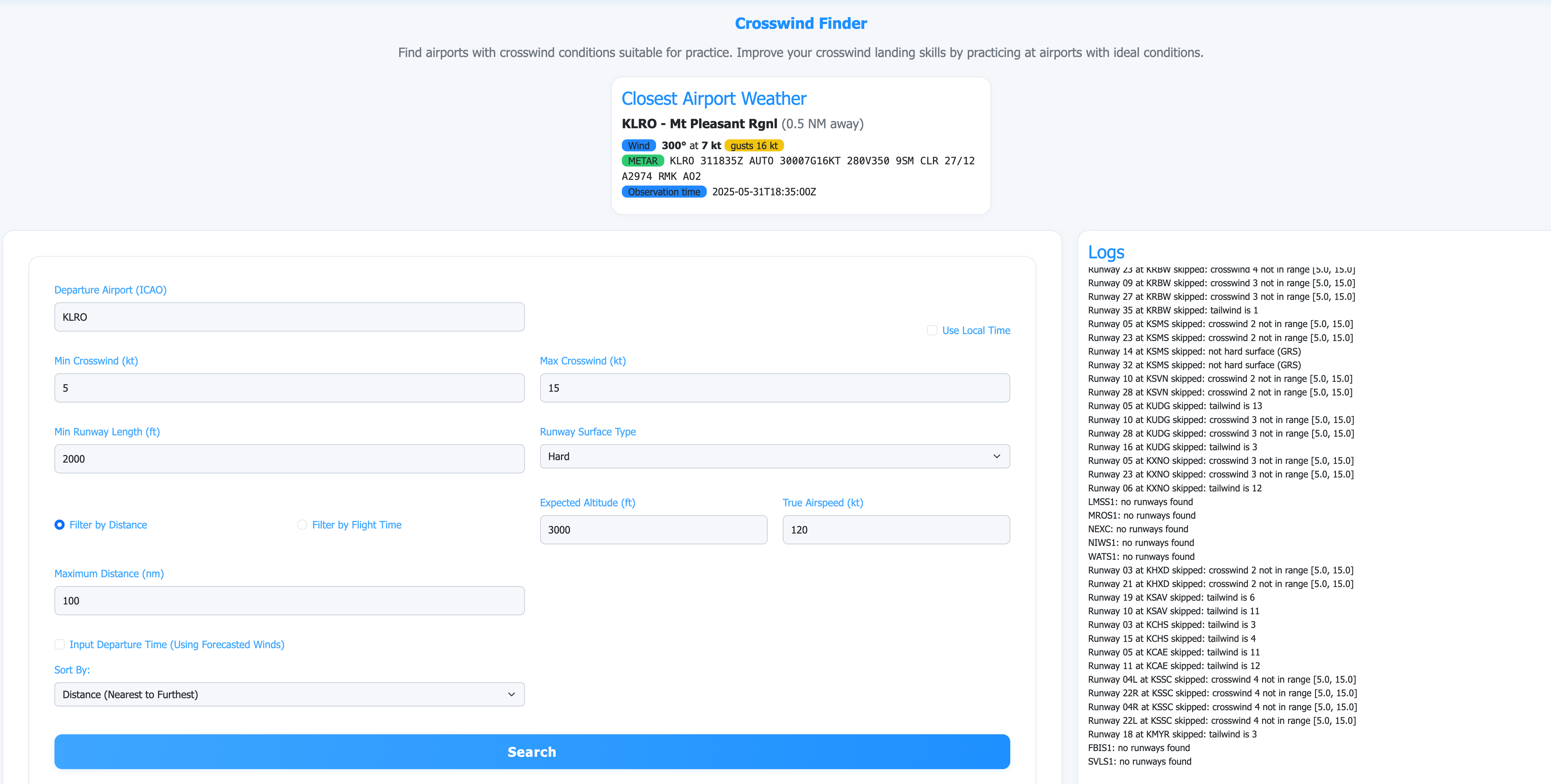
Enter a starting ICAO, tap Search, and the app lists nearby runways with their live wind components. Use More options to tighten the crosswind range, runway length, or surface, or to plan ahead against a TAF forecast time.
Short guides covering the crosswind finder, the glide-aware route planner, and the export and account features.
A quick orientation to the two main tabs. Tap a tab at the bottom of the app to jump in.
Enter a starting ICAO, tap Search, and the app lists nearby runways with their live wind components. Use More options to tighten the crosswind range, runway length, or surface, or to plan ahead against a TAF forecast time.
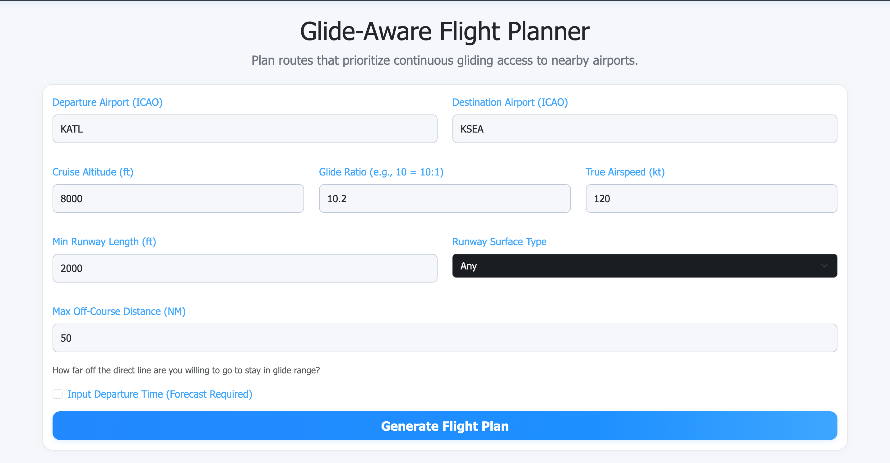
Enter departure, destination, cruise altitude, glide ratio, and TAS, then tap Generate. The result shows a plan summary, an assumptions panel, a coverage timeline (green inside glide, red outside), the fix table, and a map. If a safer alternate is offered you can accept it or keep your original route.
The crosswind finder is for any pilot who wants to find a runway with a particular crosswind component for currency or training — student, private, instrument, instructor.
You give it a starting airport and a search radius (or a maximum flight time at your cruise TAS). The finder looks at every airport in that range, pulls the current METAR — or the TAF at your planned departure time — and walks each runway. For every runway it computes the headwind/tailwind and the crosswind component from the reported wind direction and speed. It then keeps the runways whose crosswind falls inside the range you asked for and that meet your runway length and surface filters.
JFK are auto-prefixed with K).Each row is one runway at one airport, with distance, wind, the crosswind and headwind components, and the METAR/TAF observation time. The wind diagram on the right shows the wind direction relative to the runway heading. Click an ICAO link to open the official METAR or TAF at aviationweather.gov for the same airport.
The planner builds a cross-country route that prefers staying in glide range of a qualifying landing airport. It's aimed at single-engine VFR pilots who want a clear picture of how much of a route is reachable in a power-off glide, and where the gaps are.
From your departure to your destination, the planner samples points along the route and asks, for each one: given your altitude here, your glide ratio, and a safety margin, can you reach a runway that meets your runway-length and surface filters? It then bends the route through nearby airports and navigation fixes to keep more of the path inside that reachable corridor, within the off-course distance you specify.
The planner runs as a background job so longer routes (for example coast-to-coast trips) can get the extra time they need. While it works, a small translucent run panel floats over the form with the current phase, a percent-complete bar, elapsed time, and the latest planner notes. Tap Cancel on that panel if you want to abandon a long run — your inputs stay in the form.
KJFK, KLAX).Pick how aggressively the planner should detour to stay glide-safe:
The planner uses a conservative light-single default for climb and descent (500 fpm at 90 kt climbing, 500 fpm at 110 kt descending) so the glide picture during climb-out and descent is realistic. Pro pilots can enter the actual climb rate, climb speed, descent rate, and descent speed from their aircraft's POH so the profile matches what they fly. Saved aircraft can store these and reapply them with one click.
Every plan is wind-aware. For each segment of the route the planner looks up the NOAA FB/FD winds-aloft sample at the published altitude closest to cruise from the nearest FD station — that drives groundspeed and time. For each glide-safety sample along the route, the planner projects the local wind onto the bearing toward each candidate landing field and scales that field's glide ring accordingly — a tailwind toward the field extends the ring, a headwind shortens it. The adjustment is clamped to a ±35 % band so a single freak forecast can't dominate the picture. When NOAA's upper-air product isn't available, the planner falls back to the nearest reporting airport's METAR and labels the fallback explicitly in the assumptions panel.
Free pilots plan against the current valid NOAA winds-aloft window — that's what you want for "leaving in the next hour or so." Pro adds forecast planning for future flights: tick Plan a future flight with TAF forecast winds, enter when you plan to launch, and the planner layers TAF forecast winds at the planned ETA on top of the same NOAA FD baseline.
Always cross-check with an official briefing before launch — Flight Service at 1-800-WX-BRIEF or 1800wxbrief.com.
When the primary route falls below a safe coverage threshold, the planner looks for a meaningfully safer alternative and surfaces it as an offer card above the result. You opt in by tapping Use this alternate; we never swap routes on you. If the safer alternate has to bend further off-course than the limit you set, the card warns you and spells out the extra distance, time, and corridor delta so the trade-off is explicit. Keep my original route dismisses the offer.
Once the plan is generated you can:
GPX and KML are open formats — there is no app-specific deep link required, and no extra setup on the EFB.
An account is optional. Use the free tools without one. With a paid account you can:
Browse to My flight bag from the sign-in dropdown after you log in.
The free tools are funded in part by a single, low-intrusion banner below the fold on the home, crosswind, and planner pages. Anyone paying — Pro or Instructor — never sees ads, on any page. The ad-free check happens server-side, so there's no "loading ads" flicker while we figure out your status.
Use the output to inform a plan, not to make the plan for you. The pilot in command is responsible for the safe conduct of the flight.
Longer-form articles on the topics behind the tools.